News
Waypoints: how the combination of robotics, artificial intelligence enhances automatic flight planning
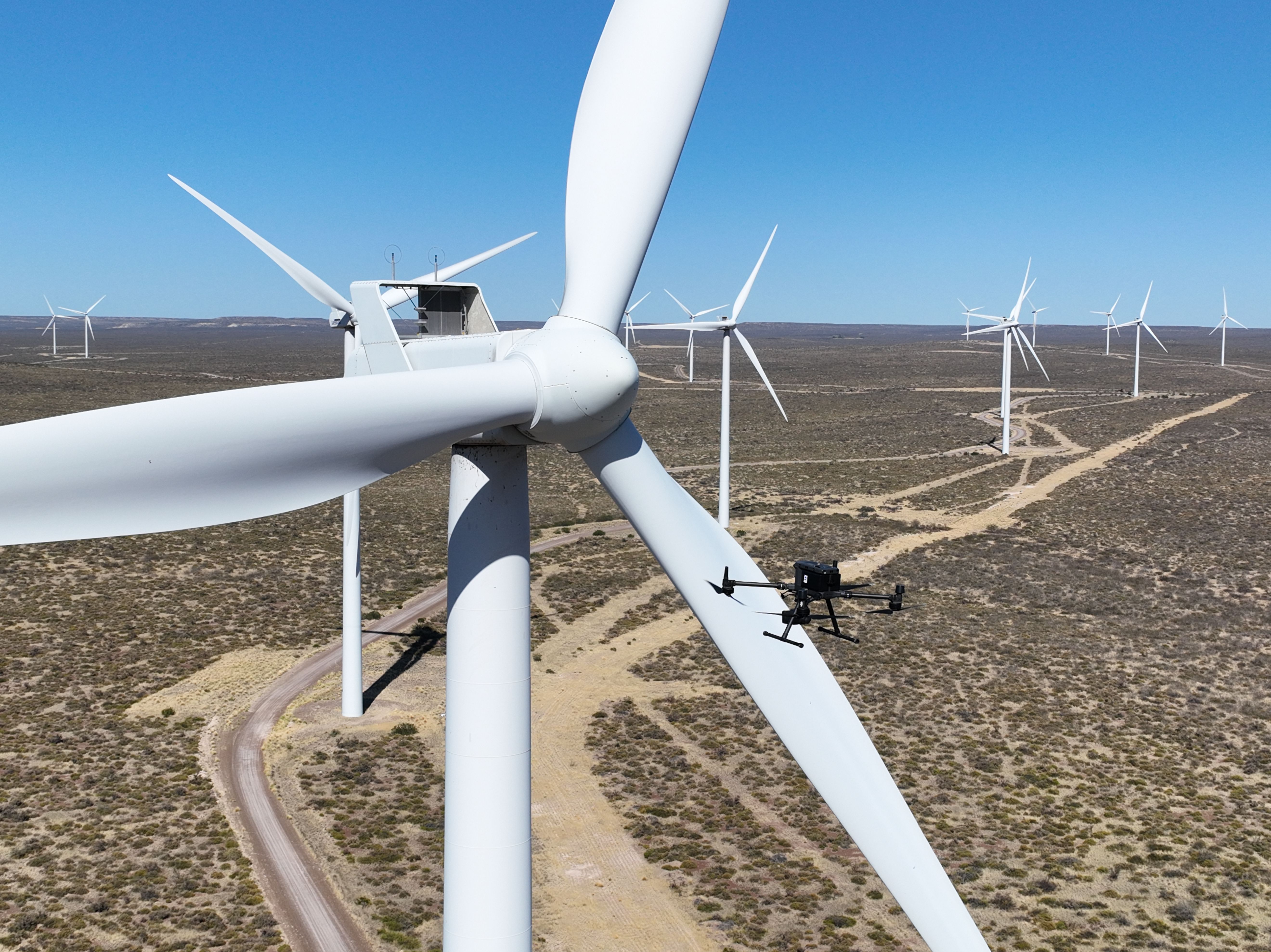
Innovation in the energy sector is not only measured by the ability to collect data, but by the precision and safety with which it is obtained. In this scenario, waypoints-based flight planning becomes a key factor in optimising field inspections and ensuring reliable results. At Uali, we combine robotics, artificial intelligence (AI) and the Internet of Things (IoT) to take smart monitoring to the next level.

What is a waypoint?
A waypoint is a GPS coordinate (latitude, longitude and sometimes altitude) that a drone must reach during its flight. But it is more than just a position: at each waypoint, actions can also be programmed, such as:
- Taking photographs or recording video.
- Changing the orientation of the camera.
- Adjusting altitude or flight speed.
- Pausing before continuing.
This ensures that every aerial mission is fully planned and tailored to the inspection objectives.
How are routes created?
Planning a waypoint-based flight involves much more than plotting points on a map. The process combines specialised software, technical precision and a clear objective.
Once the purpose of the inspection and the software to be used have been defined, the waypoints are marked on the map. The configuration consists of uploading a map of the area and selecting each point the drone must fly through. Next, parameters such as distance, altitude, speed, orientation and programmed actions are adjusted. Depending on the drone model and software, it is even possible to run a simulation of the route before starting operations, which helps anticipate potential failures or malfunctions.
Once the mission is loaded, the flight plan is stored in the drone’s memory, or alternatively in the remote controller. From there, it only needs to be executed and the drone will follow the waypoints autonomously.
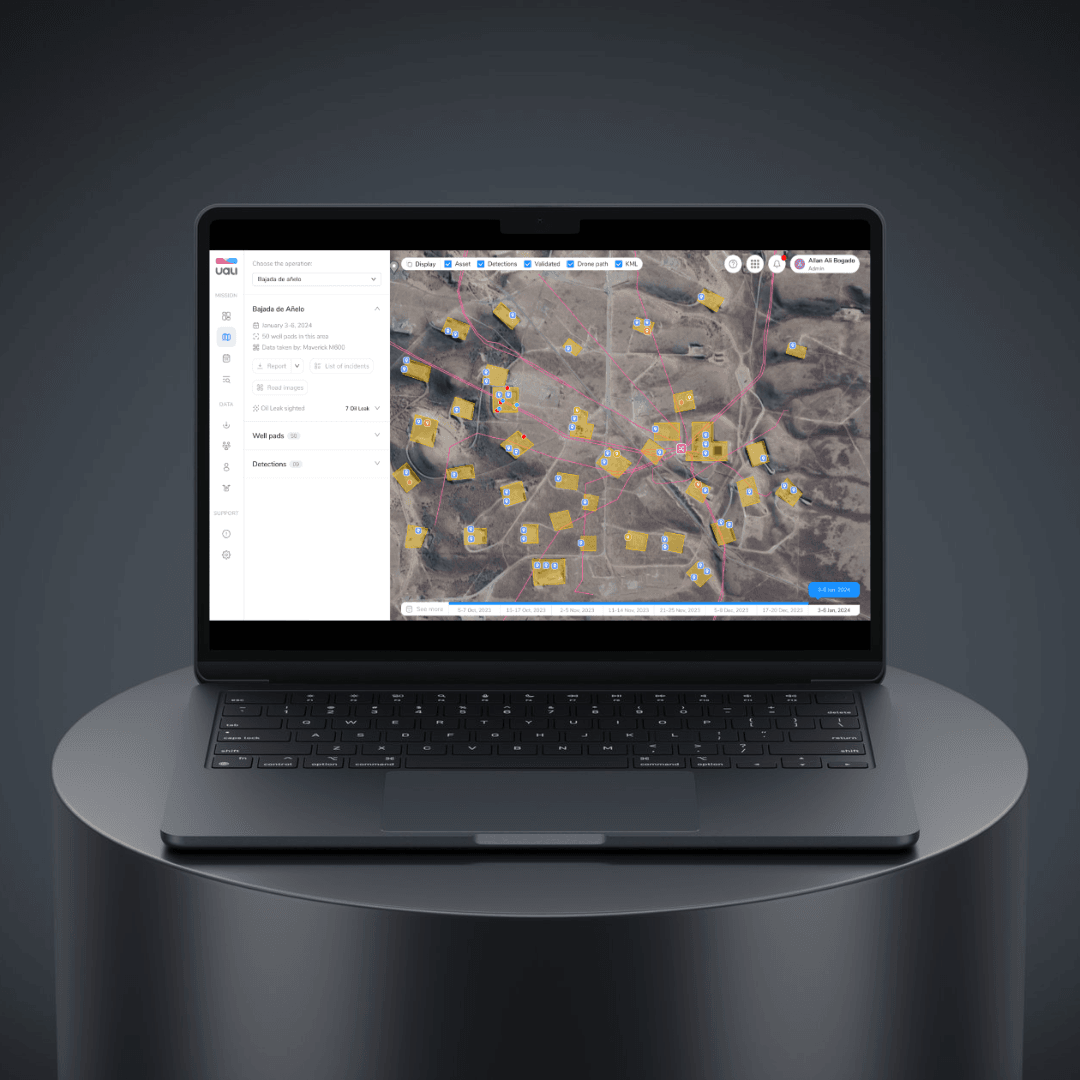
→ Interested in how we work with route recording and management? Learn more about our management platform in “Uali's management platform turns data into decisions for the energy sector.”
Uali’s advantage in asset monitoring
At Uali, we not only carry out remote inspections but also integrate the data collected from these flights into our intelligent analysis platform.
Each dataset, thanks to the inclusion of waypoints, can be tagged upon upload to determine which AI service will process the images and which will not. This enables clients to:
- Detect failures in advance.
- Extend the lifespan of their assets.
- Reduce maintenance costs.
- Minimise environmental risks.
In this way, waypoints cease to be simple coordinates and instead become part of an innovation ecosystem that drives the energy industry towards a more efficient and sustainable future.
At Uali, we combine drones with IoT and artificial intelligence to provide the energy industry with precise, actionable information, supporting decision-making processes and contributing to a positive environmental impact. Discover more about us!
Amelia Bálsamo
CTO